-
E-mail
sales@eco-tech.com.cn
-
Phone
18210150760
-
Address
101B, Unit 1, Building 6, Courtyard 3, Gaolizhang Road, Haidian District, Beijing
Product Categories
Beijing Yiketai Ecological Technology Co., Ltd


EcoDrone medium wave infrared unmanned aerial vehicle remote sensing monitoring system
NegotiableUpdate on 04/28
- Model
- Nature of the Manufacturer
- Producers
- Product Category
- Place of Origin
Overview
In recent years, with the accelerated development of industrialization in China, environmental pollution problems have become increasingly prominent. Haze, smoke, acid rain, noise, and toxic and harmful gases seriously endanger the physical and mental health of residents. Prevention and control of environmental pollution are urgent. Beijing Yiketai Ecological Technology Co., Ltd. is committed to the field of ecological environment monitoring research and prevention and control, and has accumulated rich practical experience. Based on this, combined with the practice of drone remote sensing technology, we have introduced infrared thermal imaging sensors and independently developed and integrated the EcoDrone mid wave infrared drone remote sensing monitoring system.
Product Details
In recent years, with the accelerated development of industrialization in China, environmental pollution problems have become increasingly prominent. Haze, smoke, acid rain, noise, and toxic and harmful gases seriously endanger the physical and mental health of residents. Prevention and control of environmental pollution are urgent.
Beijing Yiketai Ecological Technology Co., Ltd. is committed to the field of ecological environment monitoring research and prevention and control, and has accumulated rich practical experience. Based on this, combined with the practice of drone remote sensing technology, we have introduced infrared thermal imaging sensors and independently developed and integrated the EcoDrone mid wave infrared drone remote sensing monitoring system. This system adopts the UAS-8 unmanned aerial vehicle platform equipped with an infrared thermal imaging system. Through medium wave infrared imaging technology, it can measure large, small, medium and small temperatures in real time, monitor various toxic and harmful gases and pollutants. And it can be paired with the ENVIS air quality monitoring module with independent intellectual property rights to measure various typical pollutants in the environment and wirelessly transmit them to ground stations for users to view and analyze in real time. Provide strong data support and solutions for environmental pollution monitoring, forest fire warning, and ecological remote sensing monitoring.


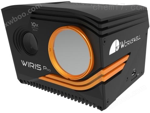
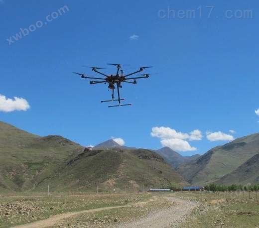
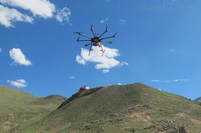
Figure 1 EcoDrone UAS-8 drone (left) GIS-320 camera (right)
1Main characteristics
- Air land dual base, compatible with EcoDrone unmanned aerial vehicle remote sensing platform, forming a Ready to fly system
- Using ultra sensitive mid wave infrared band: 3.2-3.4 µ m
- Capable of detecting a large amount of gas spectra that are invisible to the human eye
- Can simultaneously treat smoke gases (dozens of gases such as benzene, methane, ethylene, etc.)Environmental pollution gases, etcImaging monitoring
- Real time temperature imaging monitoring, online measurement of large, small, and central temperatures
- Comes with a digital camera with a resolution of 1920 x 1080 and 10x optical zoom, which is very useful for observing specific areas
- Cooling type quantum detector, capable of working at low temperatures, increases its detection capability and thermal sensitivity, making it easy to detect low concentration gases
- Multiple environmental pollution indicators can be measured online simultaneously, including air temperature and humidity CO2、PM2.5、PM10、VOC、 Formaldehyde concentration, smoke, light intensity, GPS coordinates, timestamps, etc., with over 150 types of sensors to choose from
- The ideal drone solution can be operated by a standard RC controller
- Remote control can use two input types: CAN bus and PWM
- Synchronized recording and storage of images and videos, 64GB memory, supporting external flash memory
- Modular design, independent operation
- 0.5m-Infinite focus, applicable to ground remote sensing, forming a Ground Based solution

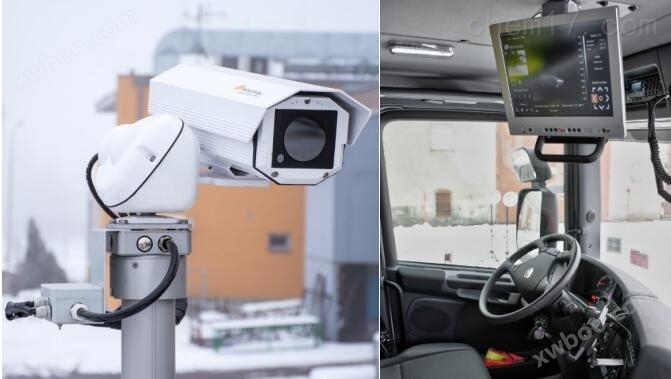
Figure 2 Industrial gas pollution monitoring

Figure 3 Monitoring of Gas Leakage
2Technical indicators
Infrared Cooling Camera (MWIR) | |
resolution |
320240 pixels |
temperature range |
Calibrated temperature range: -20 ℃...+350 ℃ |
Temperature sensitivity |
0.015℃(15mK) |
frequency |
30Hz |
spectral range |
3.2-3.4μm, Cooling InSb FPA detector (MWIR) |
lens |
24°× 18 ° or 14.5 °× 10.8 ° |
focal length |
Auto focus, small focus distance of 0.5m |
zoom |
Infrared image 1-4x digital zoom |
Special gas detection mode |
Support real-time and software visualization detection |
temperature regulation |
Support, automatic, manual, mobile span |
Visible light digital camera | |
resolution |
19201080 pixels (full HD frame), 1/3 "sensor, automatic white balance, wide dynamic range, black light compensation, exposure and gamma control |
Focal length and zoom |
Automatic focusing, 14 X-ray optical focusing with vibration compensation |
optical zoom |
10Multiple optical zoom, shock absorption compensation |
field of view |
Super zoom 6.9 ° - wide field of view 58.2 °, focal length 33.0mm-3.3mm |
Remote control&video output | |
digital interface |
S.BUS、 CAN bus、MavLink、 External GPS connection&external trigger |
Ethernet port (RJ-45) |
Video streaming and camera control, including adjustable APIs |
USB2.0port |
Keyboard connection, used for indoor or fixed application environments |
video output |
Digital HDMI 720p (1280 × 720 pixels), aspect ratio 16:9, mini HDMI |
Storage and Data Recording | |
Image and video formats |
Radiant JPEG, Digital Full HD JPEG Radiation TIFF (compatible with Pix4D and Agisoft) h.264Encode high-definition visible light video Radiated full frame infrared video (30Hz raw data recording) |
GPSlabel |
MavLinkExternal GPS or DJI A3 CAN bus interface |
storage |
Internal storage: 256GB high-speed SSD (for image and video recording) External card slot: Micro SD card&USB 2.0 flash memory (for capturing images) |
Camera function | |
Multi camera mode |
Full screen mode, infrared only mode, visible light only mode, picture in picture mode |
Measurement function |
High temperature, low temperature, center temperature |
Temperature range setting |
Automatic, manual or span mode (NUC control adjustable) |
Detectable gases (over 400 types) |
Benzene, ethanol, ethylbenzene, heptane, hexane, isoprene, methanol, MEK, Methyl isobutyl ketone, octane, pentane, 1-pentene, toluene, M-xylene, butane, methane, propane, ethylene, propylene. |
desktop software |
Thermal imaging analysis and report generation software including * |
Environment, power supply, and dimensions | |
input voltage |
9-36V DC18W power, 2 × 6.4mm coaxial cable |
Operating Temperature |
-15 ℃ to+50 ℃ |
install |
41/4-20 NUC screw hole |
Dimensions and Weight |
201×150×101mm,<1.6kg |
ENVISAir quality monitoring module | |
monitoring indicators |
Smoke VOC、 Atmospheric temperature, atmospheric humidity PM2.5、PM10、CO2、 Light intensity GPS Up to 150 professional sensors can be selected according to demand |
measurement frequency |
Updated once per second, adjustable |
Real time observation |
Wireless transmission of data to ground stations, real-time updates |
data storage |
Memory card storage |
data output |
TXTText file, capable of generating KMZ files and importing them into general third-party software such as Google Earth, GlobalMapper, ArcGIS, etc |
3Application Fields

Similar Product Recommend